What can you look forward to when wandering along the Bečva Cycle Path?
Above all, a pleasant ride through a varied landscape on a safe road. A large part of the cycle path leads along newly built sections from which motor traffic is excluded. Part of the route leads along low-traffic local roads and paved forest and field roads, and you have to spend only a minimum time on motor roads. However, projects are being prepared that will ensure that you will be able to ride from the sources of the Vsetínská and Rožnovská Bečva to the confluence of the Bečva with the River Morava without fear of car traffic.
What can you see along the way?
There are lots of interesting places. Let us randomly mention the beautiful natural environment of the Beskydy Mountains and wooden Wallachian houses scattered around the villages and towns of the region or concentrated in the Rožnov open-air museum. You will be able to stop in the centres of historic towns with many interesting monuments, such as Vsetín, Valašské Meziříčí, Hranice, Lipník nad Bečvou, or Přerov. You can visit museums, castles, and chateaux directly on the route or in its immediate vicinity. Find details in the menu, in the Tourist Destinations tab.
Rožnovská Bečva
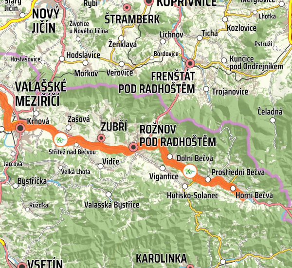
From Horní Bečva to Valašské Meziříčí
The total length of the section is 30.8 km. The route starts at an altitude of 545 metres; the destination is at a height of 291 metres above sea level. The total elevation is 254 metres, the total ascent is 229 m, and the total descent is 483 m. Most of the route leads along a cycle path from which car traffic is excluded. The sections from Valašské Meziříčí to Rožnov and from Rožnov to Dolní Bečva (approx. 21 km in total) are also suitable for roller-skating.
More infoVsetínská Bečva
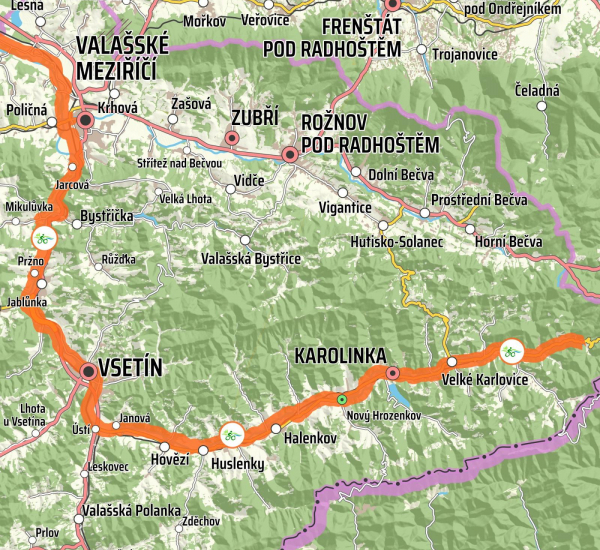
From Velké Karlovice to Valašské Meziříčí
The total length of the section is 56.8 km. The route starts at an altitude of 650 metres; the destination is at a height of 291 metres above sea level. The total elevation is 359 metres: the total ascent is 421 m; the total descent is 780 m. Most of the route leads along a cycle path from which car traffic is excluded. The section from Vsetín to Velké Karlovice (approx. 30 km) is also suitable for roller-skating.
More infoBečva
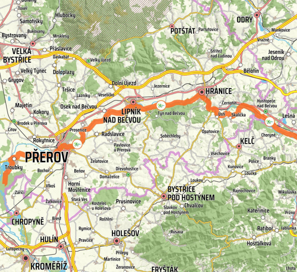
From Valašské Meziříčí to Tovačov
The total length of the section is 65 km. The route starts at an altitude of 291 metres; the destination is at a height of 194 metres above sea level. The total elevation is 97 metres, the total ascent is 341 m; the total descent is 438 m. Most of the route leads along a cycle path from which car traffic is excluded. The section from Přerov to Hranice (26 km) is practically entirely suitable for roller-skating. However, we would like to draw your attention to the long-term closure of the trail between Grymov and Oldřichov. The detour is properly marked.
More info


